Aerial Photography
Exceptional QualityEagleLens Photography has led the aerial photography and videography industry since 2014

EagleLens Photography
Aerial Photography and Aerial Videography
EagleLens Photography has led the aerial photography and videography industry since 2014
Based in Southern California, and currently serving the counties of San Diego, Orange County, and Los Angeles.
We Specialize in client satisfaction. Our FAA Certified Part 107 pilots utilize only the latest technologically advanced drones to deliver a one of a kind product for the unique needs of our clients.

EAGLELENS PHOTOGRAPHY
SERVICES

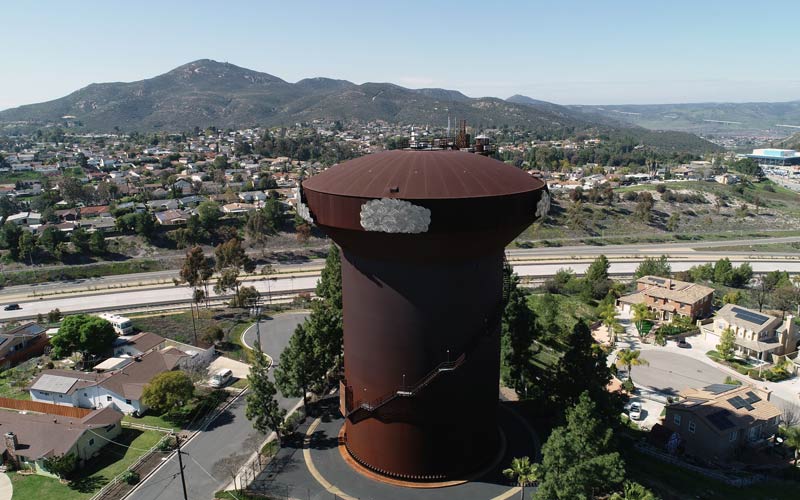
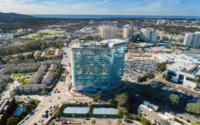
AERIAL PHOTOGRAPHY
EagleLens Photography prides itself in providing our clients with the highest quality and vision that best meets their aerial photography needs.
Our experienced pilots staff carries with them the knowledge along with the unique skills necessary to ensure that every project is accomplished as per our customer’s exact request.
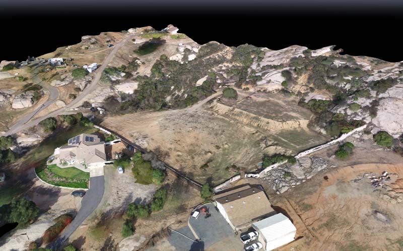
MAPPING
EagleLens provides the most technologically advanced aerial mapping and digital aerial imagery services. We create accurate land topographic maps, Orthomosaic maps, 3D mapping that can be used for construction development, civil engineering purposes, as well as assessing environmental conditions.

THERMAL IMAGING/IR/NDVI
Take advantage of Next Generations technology that now enables Commercial Aerial Thermal Imaging to a variety of new industries. The use of IR/NDVI in the commercial drone market now allows for solutions in Agriculture, Power-line inspections, Water/Hazardous Tank inspections, Sewer-line inspection, Oil Platform inspections, Bridge inspections, Windmill inspections, and many more.

AERIAL INSPECTIONS
The use of commercial drones in aerial inspections has made it possible to perform task faster, safer, and more accurate, all the while minimizing safety risk and increase overall operational efficiency. Industries such as Agriculture , Construction, Power plant, Oil rigs, windmill farms, and many others have all benefited from the use of commercial aerial inspections. Let us know how we can help you take advantage of this new era in inspection services.
EAGLELENS PHOTOGRAPHY
SERVICES
AERIAL PHOTOGRAPHY
EagleLens Photography prides itself in providing our clients with the highest quality and vision that best meets their aerial photography needs.
Our experienced pilots staff carries with them the knowledge along with the unique skills necessary to ensure that every project is accomplished as per our customer’s exact request.
MAPPING
EagleLens provides the most technologically advanced aerial mapping and digital aerial imagery services. We create accurate land topographic maps, Orthomosaic maps, 3D mapping that can be used for construction development, civil engineering purposes, as well as assessing environmental conditions.
THERMAL IMAGING/IR/NDVI
Take advantage of Next Generations technology that now enables Commercial Aerial Thermal Imaging to a variety of new industries. The use of IR/NDVI in the commercial drone market now allows for solutions in Agriculture, Power-line inspections, Water/Hazardous Tank inspections, Sewer-line inspection, Oil Platform inspections, Bridge inspections, Windmill inspections, and many more.
AERIAL INSPECTIONS
The use of commercial drones in aerial inspections has made it possible to perform task faster, safer, and more accurate, all the while minimizing safety risk and increase overall operational efficiency. Industries such as Agriculture , Construction, Power plant, Oil rigs, windmill farms, and many others have all benefited from the use of commercial aerial inspections. Let us know how we can help you take advantage of this new era in inspection services.
UTILIZING LATEST TECHNOLOGIES
Along with skills, knowledge, and experience, we believe that it is equally important that our equipment stays up to date with current and latest technology available. In doing so, we are confident that we will be able to accomplish any complex tasks that may be requested of us.
EAGLELENS PHOTOGRAPHY
Happy Clients

checkout our Instagram profile for more images

Find the latest promotions in your inbox
ABOUT
CONTACT US
San Diego
(858) 324-5312
info@eaglelensphotography.com
© 2021 EagleLens Photography | All rights reserved